|
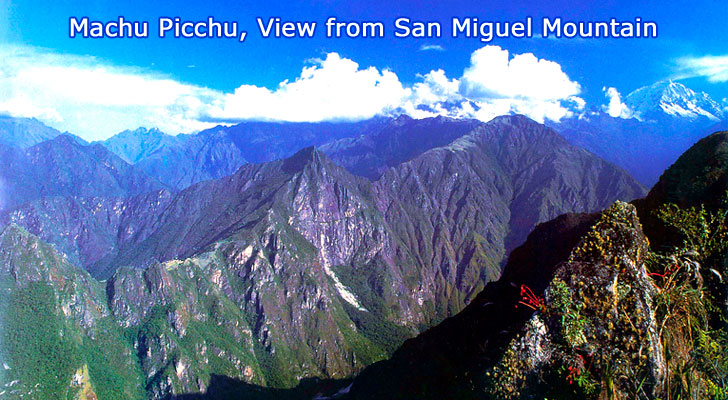
Machu Picchu, view from the
North-West at San Miguel Mountain:
-
Machu Picchu
Sanctuary, Altitude: 7,711 feet. View
from the North-West at San Miguel
Mountain.
-
Huayna
Picchu Mountain. Altitude: 8860 feet.
(Quechua: "Young Peak") is a mountain
around which the Urubamba River bends.
It towers over the Machu Picchu and
divides it into sections. The Incas
built a trail up the side of the Huayna
Picchu and built temples and terraces on
its top. The Temple of the Moon is
located on the mountain.
-
Urubamba
River
A partially navigable headwater of the
Amazon River, it rises in the Andes to
the south-east of Cuzco and flows for
724 kilometers before coalescing with
the lower Apurimac River to form the
Ucayali River. A number of ruins of the
Inca Empire lie in the valley, including
the Incan city of Machu Picchu.
-
San Miguel
Mountain. Altitude: 9,593 feet.
A place to worship sacred geographical
features in combination with equinox
alignment.
-
Inca Bridge
-
Inca Trail:
Intipunku, the Gateway of the Sun, 8068
feet, is located high above the city of
Machu Picchu. A path leads down from
Intipunku towards the city, giving some
impressive views over the ruins.
-
Machu Picchu
Mountain. Altitude 10,040 feet.
-
Inca Trail:
Phuyupatamarca. Cloud Level Town,
Altitude: 11,975 feet.
-
Salkantay
Mountain, Altitude: 20,574 feet.
Salkantay means 'Savage Mountain' which
may refer to the swirling clouds that
rise up from the jungle lowlands and
engulf the peak.
-
Aguas
Calientes & Urubamba River. Altitude:
6,560 feet
Aguas Calientes is connected to Machu
Picchu by an unpaved road. Buses run
frequently between Aguas Calientes and
Machu Picchu. The journey takes about 20
minutes and costs US$6 each way.
Putucusi, a mountain opposite the river
from the ruins, is a popular hike and
provides excellent views.
-
To Cuzco.
Altitude: 11,500 feet.
The distance from Cuzco to the Machu
Picchu area is about 75 miles and the
train ride took between 3 and 4 hours.
It was slow and stopped often, being a
local train. On the steeper slopes, the
rail line was constructed with zig-zags
where the train pulled forward up the
zig, then backed up the zag and repeated
this to get up the slope. Past
Ollantaytambo there is no road, only the
rail line into the mountains. So about
the last 30 miles into Aguas Caliente
are along the river on the only access
route other than a foot trail.

Hiram Bingham.
The American explorer who found the ruins of Machu Picchu in 1911.
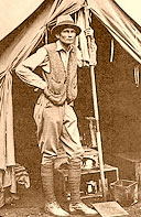
Hiram Bingham at Machu Picchu
The inspiration for Indiana Jones?
|